Real time location systems can locate and track any person or item within a specified RF coverage area. Choosing the right tracking technology can help companies track their employees and equipment. This article focuses on the types of real time location systems and some related applications.
What are Real Time Location Systems?
A Real Time Location System (RTLS) can also be called a Real Time Tracking System. It is mainly used to identify and track specific targets through a series of systems that can locate and manage assets. The targets they track can be people or objects. It can track the time of assets and rely on different applications to use that data differently. A typical example: some applications only provide a timestamp of when an asset passed through a certain area. Other RTLS applications may need to gain real-time and more granular visibility.
Wikipedia describes the origin of real-time positioning systems:
The term RTLS was created (circa 1998) at the ID EXPO trade show by Tim Harrington (WhereNet), Jay Werb (PinPoint), and Bert Moore (Automatic Identification Manufacturers, Inc., AIM). It was created to describe and differentiate an emerging technology that not only provided the automatic identification capabilities of active RFID tags, but also added the ability to view the location on a computer screen.
Most RTLS are embedded in products like smartphones or some navigation systems. RTLS consists of a wireless node that transmits the signal and a reader that receives it. It is mainly based on wireless technologies such as Bluetooth, RFID, GPS, etc.
RTLS can be used in several industries. These industries can be healthcare, military, retail, and entertainment. Some industries with specific applications, such as manufacturing and mining, are also applicable.
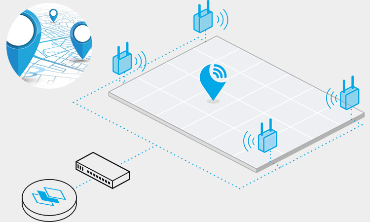
RTLS System Parts
Real-time location system solutions automatically track people, equipment, or assets through a facility or area. An RTLS system consists of a few core components, including:
- Transponders: Small tags or labels attached to the items you want to locate. Transponders broadcast a uniquely coded radio frequency signal identifying the transponder’s ID and location.
- Receivers: Placed throughout the area of interest to detect the signals from nearby transponders. Receivers translate the signals into location data that determines the position of each transponder.
- RTLS Software: Integrates the data from the receivers to calculate locations using algorithms like trilateration. The software displays the locations and movements of transponders on maps or diagrams, allowing real-time monitoring of their positions.
The technologies and system design used to depend on the accuracy and coverage needed for your specific application. Options include:
- Radio frequency (RF) – Uses radio waves for short-range tracking. Good for indoor spaces.
- Ultra-wideband (UWB) – Uses radio pulses for precise localization tracking. High accuracy option, even for dense deployments.
- Wi-Fi – Leverages existing wireless network infrastructure for localization. Limited accuracy but low cost.
- Infrared – Uses light signals for line-of-sight tracking. Short range, but no radio frequency license is needed.
- Zigbee – Uses a network of low-power transceivers for tracking. Moderate range and accuracy, low cost.
- Cloud-based RTLS – Combines signals from multiple technologies and algorithms in the cloud for enhanced accuracy, range, and scalability.
How does a Real Time Location System Work?
The specific mode of operation of the real time location systems varies depending on the system selected. It all has in common that all RTLS utilizes a network of connected hardware and software components. They will track the location of people or objects within a specified area. Most RTLSs will rely on RFID technology.
These radio frequency technologies can be UWB, Bluetooth, WiFi, and RFID. They can perform wireless communication between a set of transmitting. And receiving devices or in a device that is both transmitting and receiving. They mainly do determine the location of the target. When the tag emits a radio signal, the receiver immediately receives it and sends it to the server. The RTLS software in the background will process it synchronously. When the anchor receives a signal, it uses triangulation or other similar methods to calculate the exact location of the tag. This calculation is done by a designated location engine, part of the RTLS software.
Most trucks, people, pets, and industrial tracking applications use RTLS. Authorized users can generally obtain location data of marked items through a local computer or cloud platform.
How Far is the Tracking Range of the Real Time Location Systems?
The range of a real-time location systems can vary depending on the underlying RF technology and deployment type. Some users need accuracy in tracking within a narrow area, such as the exact location of a specific part as it moves down an assembly line. Some users need a broader range to track assets such as containers, equipment, or people in certain hard-to-reach areas.
The range varies depending on the real-time location systems used. Chirp and WiFi-based systems can provide remote access to more than 300 meters. The other technologies, such as UWB and BLE, can track items only to a limited extent.
What are the Types of RTLS?
Many technologies can implement RTLS applications. When implementing RTLS, choosing the right technology based on the requirements is critical.
Radio Real Time Location Systems Tag: Passive RFID Tag
Passive Ultra High Frequency (UHF) RFID offers ways to create RTLS efficiency. We can do this in the easiest way possible. That is by covering choke points at the entrance/exit of a particular room or building. We installed an RFID reader and antenna at the location of the blocking point and used RFID tags to tag this asset. This operation allows us to get the item position at a specific read time. We can also achieve zonal coverage by dividing the area and strategically placing RFID antennas. The RFID antennas in that area will send signals to the tagged asset. Passive UHF RFID, on the other hand, uses the same tagging methods as other RTLS technologies. They can both determine the location of a tagged asset by installing antennas every few meters and taking many measurements. They can even employ more granular tagging methods within the tracking area.
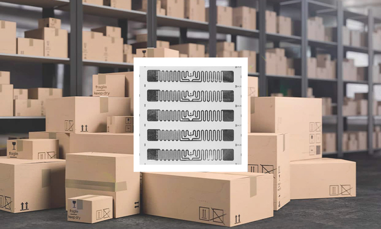
- Passive RFID Applications: Supply chain tracking, Inventory tracking, Asset tracking
- Passive RFID Suitable for: Local area coverage, Choke point coverage, Regional coverage
- Passive RFID Advantages: Relatively inexpensive tags, Standardized technology
- Passive RFID Disadvantages: Susceptible to metal and liquid interference, Multi-path environments
Related Articles: What is Passive RFID Tags Used for?
Radio Real Time Location Systems Tag: Active RFID Tag
Our common active UHF RFID is mostly used for RTLS in large outdoor environments. Active RFID has a read range of up to hundreds of meters. Unlike passive RFID tags, active RFID tags do not require a reader to send a signal to obtain energy. It contains a battery inside, allowing continuous signal broadcast. The user can set the interval length between tag broadcasts according to the manufacturer’s options.
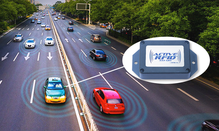
The tag sent its unique ID number and programmed data information to the receiver. This data information can be signal strength or environmental measurements. When a reader installed at a specified location receives an active RFID tag signal, it records its information and location. It then synchronizes the location information and uploads it to a host or networked/cloud database.
- Active RFID Applications: Vehicle tracking, Mining
- Active RFID Suitable for: Area coverage, Local area coverage
- Active RFID Advantages: Extremely rugged tagging options, Telemetry options
- Active RFID Disadvantages: Expensive, No standard for active RFID
Related Articles: What are Active RFID Tags?
Low Power Bluetooth Real Time Location Systems
Most people use low-power Bluetooth (BLE) for real time location functions. Based on user settings, BLE tags can propagate signals to the surrounding area without interruption. Any Bluetooth-enabled electronic device can receive these signals. Some common Bluetooth-enabled devices are Bluetooth receivers, beacons, and smart devices. The user can use a Bluetooth receiver to set up the RTLS using BLE or a beacon mounted in a fixed location with specific coordinates.
After the user sets up the RTLS function of BLE, it will run automatically. The BLE transponder enters the specified reception range. The transponder will communicate its location information directly to the receiver. Next, the receiver will send the information to the BLE gateway via WiFi. The BLE gateway will record its location information synchronously and send the data to the host or networked/cloud database.
- BLE Applications: Location tagging, Asset tracking, Medical sensors
- Suitable for: Blocking point coverage, Area coverage
- BLE Advantages: Standardized technology, Works with Bluetooth devices, Telemetry options
- BLE Disadvantages: Labels are in considerable demand, High cost
Global Positioning System (GPS)
The Global Positioning System (GPS) is also known as the Global Navigation Satellite System (GNSS). It has a fairly wide coverage area, almost all over the world.GPS gets its name from the NAVSTAR GPS satellite system. It is the most well-known satellite system used for GNSS navigation or positioning in the United States. In most cases, one can use GNSS tags to tag assets for real time positioning capabilities. These tags will likewise have WiFi, Bluetooth, or cellular connection technology.
Satellites orbiting the Earth non-stop will transmit signals to GNSS tags or smart devices via radio waves. The emitted signals will carry information about their orbital position and the time of a precise atomic clock. The tag receives information from these satellites. It also calculates the tag’s position by matching this data to global coordinates. This coordinate information is sent to the host computer via an assistive technology on the tag (e.g., Bluetooth).
- GPS Applications: Positioning, Navigation
- GPS Suitable for: Local area coverage, Global coverage (up to 98%)
- GPS Advantages: Only mark the cost, Telemetry options
- GPS Disadvantages: High tagging cost, Limited outdoor tracking
Infrared Radiation
The electromagnetic spectrum of infrared radiation is quite low and lower than the visible light that the human eye can detect. It has certain limitations. For example, for some thick solid objects, infrared radiation cannot pass directly through. However, it is also suitable for use in various areas and rooms. When the infrared tag is used with technologies such as WiFi or Bluetooth, it can provide considerable accuracy over a wide area. The infrared body contains a small battery that transmits a signal modulated by its unique ID into a designated room or area. Users can install the infrared receiver in a fixed location for receiving data information from the tag according to their needs. The receiver will connect via WiFi or LAN and forward this data information to the host computer or database.
- Infrared Radiation Applications: Infrared radar, Infrared detector
- Infrared Radiation Suitable for: Area coverage
- Infrared Radiation Advantages: low cost, High accuracy
- Infrared Radiation Disadvantages: Multi-path issues, No standards
What is the Difference Between RFID and RTLS?
RFID and RTLS are two types of tracking technologies used to locate objects or people. Here are the main differences between them:
- Range: RFID can only track items within a few meters, while RTLS can cover much larger areas, such as hundreds of meters.
- Precision: RFID can precisely track an object or person within a few centimeters. RTLS is generally accurate within a few meters.
- Real-time tracking: RTLS provides instant location updates, while RFID requires a reader to be nearby to detect the tag’s location.
- Cost: RFID tags are usually cheaper, but setting up the infrastructure can be more expensive for larger systems. RTLS is typically more expensive overall.
- Application: RFID is often used for inventory management, access control, and tracking individual items. RTLS is used more for location-based services, fleet management, and tracking assets in large facilities.
This table outlines the differences between RFID and RTLS:
| Feature | RFID | RTLS |
|---|---|---|
| Full Form | Radio Frequency Identification | Real-Time Location System |
| Usage | Used to identify and track objects | Used to track and locate people, objects, and assets in real-time |
| Technology | Uses radio waves to read and capture data from RFID tags attached to objects | Uses various technologies including GPS, Wi-Fi, and Bluetooth to track and locate objects |
| Accuracy | Can have accuracy up to 99% | Can have accuracy up to 10 cm |
| Distance | Can read tags from several feet away | Can locate objects within a few meters |
| Cost | Typically lower cost than RTLS | Typically higher cost than RFID |
| Implementation | Can be implemented in various industries, including retail, healthcare, and logistics | Commonly used in industries such as manufacturing, warehousing, and healthcare |
| Real-Time Tracking | Not designed for real-time tracking | Designed for real-time tracking and monitoring |
| Data | Captures limited data about the object | Captures more detailed data about the object, including location, movement, and environmental conditions |
In summary, RFID and RTLS are used to track objects or people but differ in range, precision, real-time tracking capabilities, cost, and application. Of course, the choice of technology depends on the specific needs of the application.
Related Articles: RTLS vs RFID: The Difference Between RFID and RTLS Tracking
Application Examples of Real Time Location System
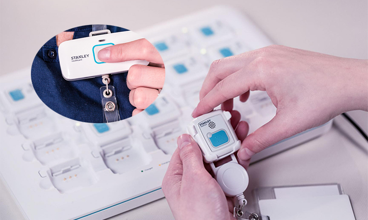
Emergency Call
Businesses can track the location of employees during emergency evacuations with the RTLS badge. In an emergency, the muster system automatically records arriving employees as safe. In this crisis, emergency managers don’t need to rush through a roll call to get a list of people who may be at risk. They can provide first responders with real-time location information of at-risk employees. They will assist them in rescues.
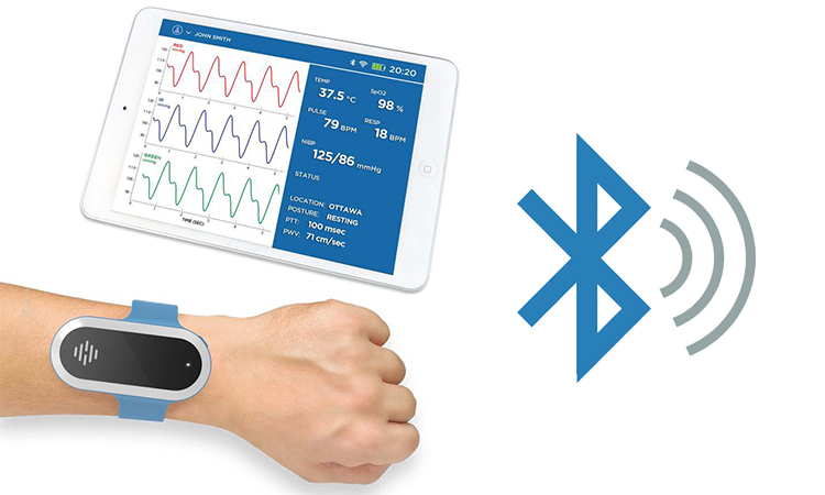
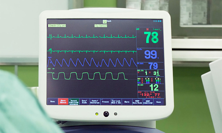
Real Time Location Systems in Healthcare: Patient Monitoring
The speed at which data is processed is critical to the healthcare industry—the difference between life and death. People can use real-time location systems in patient monitoring systems (e.g., heart rate monitors). The data detected by the system helps clinicians ensure patient safety and health. When a patient’s life is in danger, the system will sound an alarm. The physician will be the first to arrive and provide assistance.
Related Articles: Telemetry Unit in a Hospital
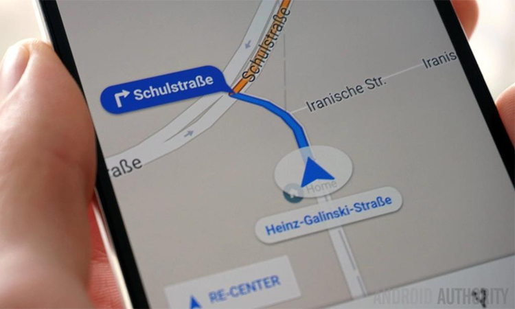
Real Time Location Systems in Logistics
Real Time Location Systems (RTLS) have become an essential tool in logistics and supply chain management. It provides real-time visibility into the location and movement of assets, vehicles, and personnel within a logistics network. This helps organizations optimize operations, reduce costs, and improve customer satisfaction.
A common real time location system we see is navigation. It provides information on how to get from point A to point B regarding location. GPS, maps, and mobile cellular technology are even more powerful. It can provide more complex navigation services.
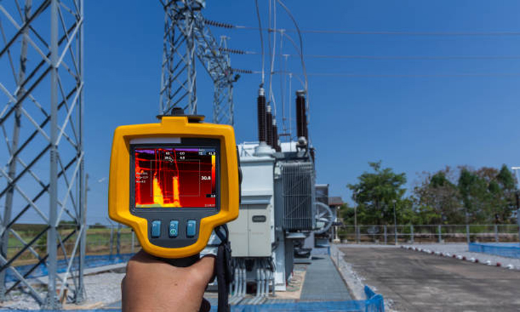
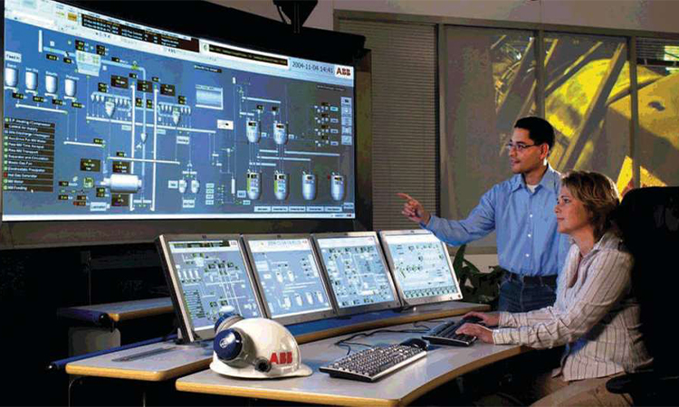
Real Time Location Systems in Industrial Applications
It is suitable for industrial applications where continuous production is not interrupted. These systems monitor data and processes for troubleshooting. They help companies maintain product quality and improve performance. Most companies in the oil and gas industry choose to use process control systems. It allows companies to be more efficient and safely run their facilities. It also helps companies reduce losses due to downtime.
Real Time Location Systems in Asset Tracking
Monitoring and tracking the movement of your equipment and tools is an essential function of RTLS. With the right tracking technology, you can find tools left behind by workers in large facilities. It also keeps equipment safe and ensures no equipment leaves its designated area.

Real Time Location System Market Trends
Real Time Location Systems (RTLS) track and locate assets, equipment, and people in real-time. The global RTLS market is expanding rapidly and is projected to grow at a CAGR of about 25% between 2021 and 2026. Let’s take a closer look at some of the significant trends in the RTLS market:
- In healthcare, RTLS is becoming more prevalent. The healthcare industry is one of the fastest-growing sectors in the RTLS market, with applications in patient tracking, asset tracking, and staff tracking. With the onset of the COVID-19 pandemic, hospitals are using RTLS to track patients and medical equipment in real time.
- In manufacturing and logistics, RTLS is increasingly popular. The manufacturing and logistics sectors have been using RTLS for several years to track inventory, monitor supply chains, and optimize workflow. The adoption of Industry 4.0 technologies has further increased the demand for RTLS in these sectors.
- RTLS capabilities are enhanced with 5G and IoT. The emergence of 5G and the Internet of Things (IoT) has significantly improved the capabilities of RTLS systems. With 5G, faster data transfer rates, lower latency, and increased device connectivity are possible. This will enable more efficient and accurate RTLS solutions.
- Integration with other technologies. RTLS systems are being integrated with other technologies such as AI, machine learning, and Big Data analytics. This integration enables more sophisticated data analysis and helps businesses make better decisions.
- Wireless RTLS solutions are increasingly popular. Wireless RTLS solutions are becoming increasingly popular due to their flexibility, scalability, and ease of deployment. These solutions use technologies such as Wi-Fi, Bluetooth, and RFID, which are widely available and easy to use.
With the advancement of science, there are numerous options for real-time location systems. People can choose tracking technologies such as Bluetooth, RFID, and optical to determine the location of people or items. It provides a more convenient way for people to locate their location. It has many benefits for various industries. We will see it in more places soon.
*Video Source:
About Real-time Location System Q&A
-
What is a Real-time Location System, and How does It Work?
A real-time location system (RTLS) is a technology that uses a combination of hardware and software to track the real-time location of people or objects within a defined area. RTLS uses wireless signals such as Wi-Fi, Bluetooth, RFID, GPS, and other technologies to transmit location data to a central software platform.
-
What are the Different Types of Real-time Location Systems Available, and What are Their Advantages and Disadvantages?
The different types of real-time location systems available include Wi-Fi-based, Bluetooth-based, RFID-based, GPS-based, and hybrid systems. Each has its advantages and disadvantages, depending on the specific use case. For example, Wi-Fi-based systems have high accuracy and are best suited for indoor tracking, while GPS-based systems are more accurate for outdoor tracking.
-
How Accurate are Real-time Location Systems, and What Factors Affect Their Accuracy?
The accuracy of RTLS can vary based on the technology used, the environment, and other factors. Wi-Fi-based systems can achieve an accuracy of a few meters, while GPS-based systems can achieve sub-meter accuracy. Factors that affect accuracy include signal strength, interference, and the number and location of access points or tags.
-
What are Some of the Most Common Applications for Real-time Location Systems, and How do They Benefit Organizations?
RTLS is used in many industries, including healthcare, logistics, retail, and manufacturing. Common applications include asset tracking, inventory management, personnel tracking, and safety monitoring. RTLS can help organizations improve efficiency, reduce costs, and enhance safety.
-
What are the Key Considerations When Selecting a Real-time Location System for a Specific Use Case?
Key considerations include the accuracy and reliability of the system, the cost of implementation and maintenance, the compatibility with existing infrastructure and systems, and the level of support offered by the vendor.


